Data Access
The first version of the FDR4LDYN data record will be accessible in the Data section as soon as it becomes available. Subscribe to our newsletter to be notified when it is released.
The project team has finalised the first complete version of the FDR4LDYN data record (v0.1.0).
ESA earth online published a news article on the FDR4LDYN project, discussing the project's progress and milestones.
The FDR4LDYN project will be featured at the ESA Living Planet Symposium 2025 in Vienna.
The first major milestone of the FDR4LDYN project – the Critical Design Review (CDR) – will take place from 7 to 8 May 2025 in Vienna.
The first version of the FDR4LDYN data record will be accessible in the Data section as soon as it becomes available. Subscribe to our newsletter to be notified when it is released.
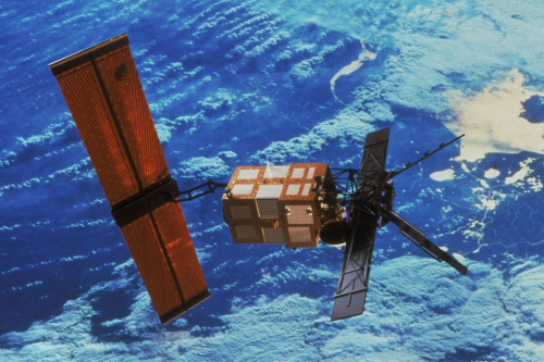
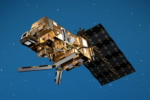
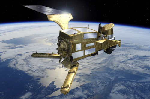
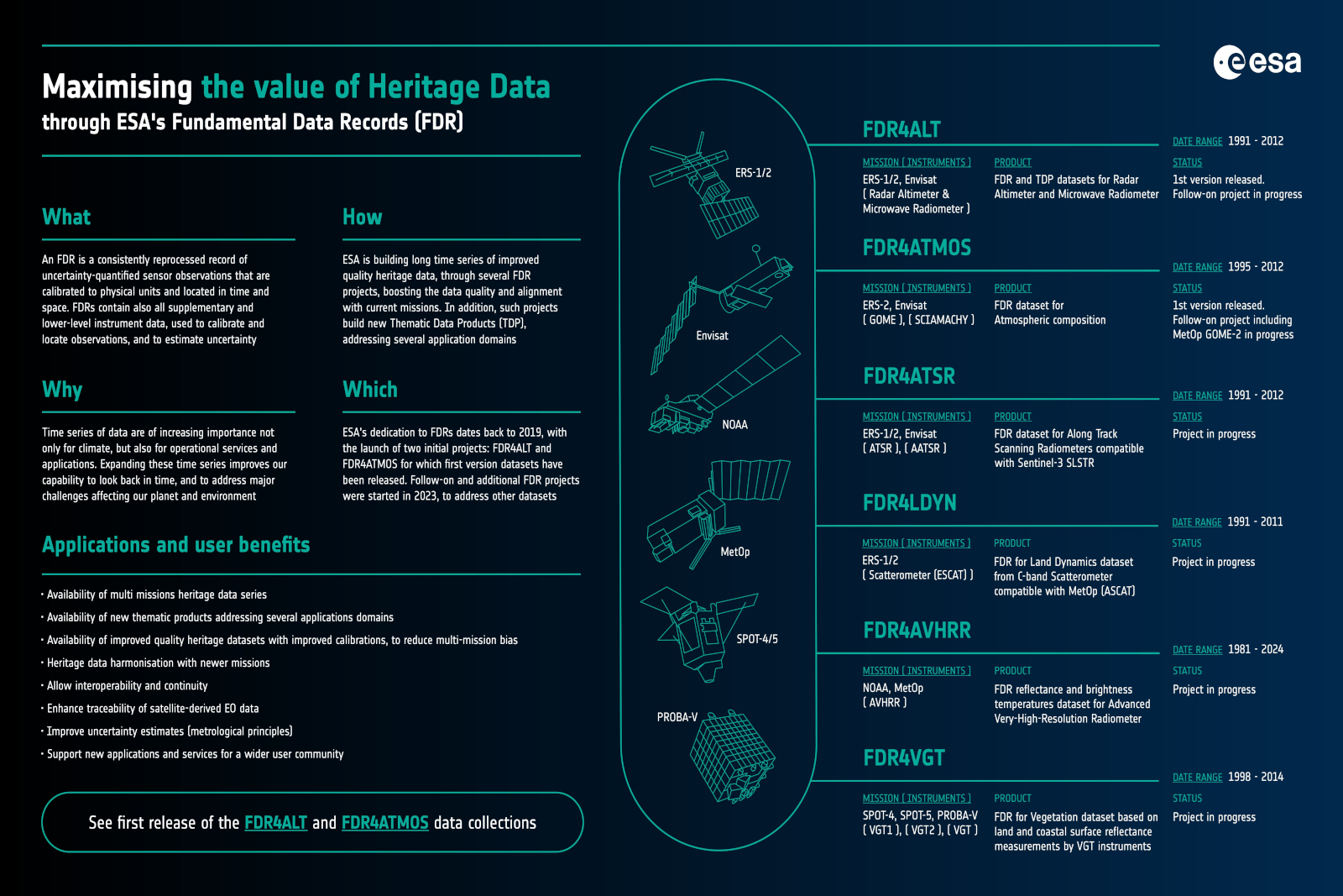
Since 1991, Europe’s C-band scatterometers – from ERS-1 and ERS-2 (ESCAT) to the Metop series (ASCAT) – have collected one of the world’s longest and most consistent radar backscatter records. With Metop-SG (SCA) satellites soon joining the series, this record will extend into the 2040s, offering over four decades of continuous Earth observation with consistent frequency, viewing geometry and orbit characteristics.
FDR4LDYN (Fundamental Data Record for Land Dynamic) is a project dedicated to transforming the ERS heritage into a harmonised, analysis-ready data record. Commissioned by the European Space Agency (ESA), the project is carried out by TU Wien in collaboration with TU Delft. Within this project, we are inter-calibrating ESCAT with ASCAT to ensure consistency across missions, laying a robust foundation for future interoperability with SCA. While the FDR4LDYN data record focuses on ESCAT observations, it is being prepared for seamless integration with ASCAT and SCA to enable unified access to key backscatter observables: backscatter, slope, and curvature.
To ensure interoperability, we assess the robustness of ESCAT backscatter observables by generating synthetic ASCAT time series that mimic ESCAT’s lower observation density. We also revisit data quality and perform beam-wise intra-calibration to refine consistency within ERS measurements before performing the inter-calibration with ASCAT. Additionally, we explore azimuthal effects, their correction procedure, and error propagation. To meet diverse user needs, we develop and compare multiple versions of slope and curvature, ranging from robust climatologies to variants optimised for capturing short-term dynamics.
In the final project stage, we will demonstrate the scientific potential of this data record for monitoring land surface dynamics through three use cases:
Beyond the science, we prioritise user access and feedback. Our datasets will be openly published and accompanied by tailored Jupyter Notebooks that guide users through data access and analysis. The goal: foster a growing community around long-term radar-based land surface monitoring. Join us in this mission!
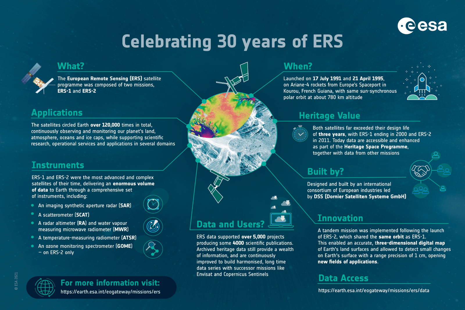
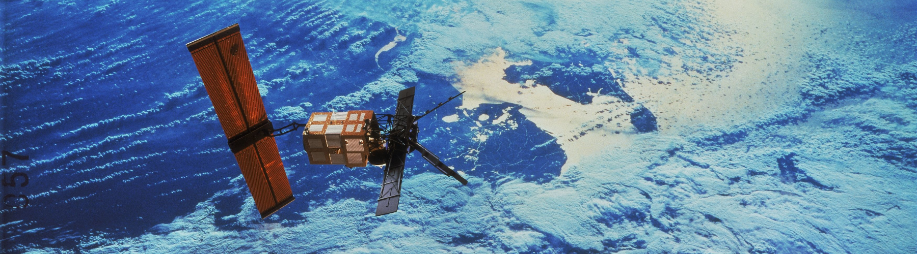
ESA’s first Earth observation mission dedicated to understanding our planet, the European Remote Sensing satellite (ERS-1), was launched into orbit on 17 July 1991 – almost 30 years ago today. At the time of its launch, the ERS satellite was one of the most sophisticated spacecraft ever developed and launched by Europe, paving the way for satellite technology in the areas of atmosphere, land, ocean and ice monitoring.
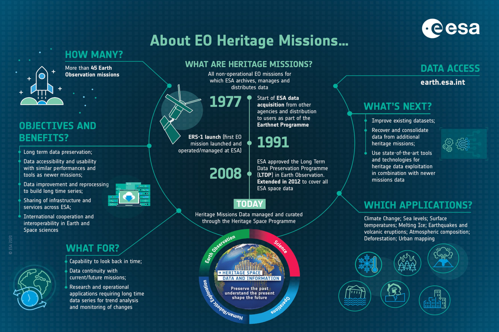
The ESA Heritage Mission programme ensures that data from key missions that are no longer operational – like the European Remote Sensing satellites (ERS-1 and ERS-2) – continue to aid in present-day scientific studies, which have extensive benefits for our society and the ongoing environmental research of the planet.
More than 40 years of preserved Earth observation data, from over 45 remote sensing missions, are available in total. The preservation of these data supports environmental and climate change research, helping scientists discover major breakthroughs in the fight against global warming. Furthermore, information from these missions is also used to support the development of a wide range of operational applications whilst enabling harmonisation between past, present and future missions and their associated data.
FDR4LDYN is a substantial part of ESA’s Fundamental Data Records (FDR) framework, which is currently the main instrument to promote innovative efforts to enhance datasets from selected Heritage missions. FDR enhancement projects are addressing data quality improvement and the creation of multi-mission long-time heritage data series, making them more compatible and aligned with current missions’ data, improving and extending their use, in particular for long-term studies (for instance, climate change).
Sign up here to receive occasional updates about the FDR4LDYN project. We will only reach out when it matters – for example, when new versions of the data record are released, when we identify important issues in existing products, or when we share key findings from our scientific use cases. Be the first to know and help us shape the future of long-term scatterometer data for land applications.